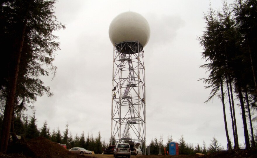
If you ever want to see KPLU weather expert Cliff Mass get passionate, just ask him about the coastal radar system.
“Weather radar is one of the most powerful tools that meteorologists have to see what’s going on,” he says.
You can hear the excitement in his voice as he makes an analogy to the technology used in modern medicine to see inside patients’ bodies.
“You know if you’re a doctor and you want to diagnose someone’s innards, you need an MRI or a CT scan.”
Weather radars are the equivalent of “weather CT scans,” Mass says, because “for instance, weather radars show us where it’s raining. And how hard it’s raining. That’s very valuable.”
He says the value comes from being able to see the internal structures of weather systems such as pressure fronts or cyclones, “to see exactly where the precipitation is and how it’s moving.”
Even Better Than X-Rays
Modern weather radars, called Doppler radars, not only show where the atmosphere is precipitating, they can measure winds as well.
“They can measure the velocity of particles, towards or away from us,” Mass says. “So we can get the velocity field, the wind field as well … In fact it’s even better than that,” he exclaims.
“The modern national weather service radars are what’s called ‘polar metric radars.’ And they can actually measure the shape of precipitation particles, so we can see what’s a raindrop, what’s a snow crystal. And we can even use that to figure out precipitation intensity – with a lot of accuracy,” he says.
All of this excited description is to make his main point, about how weather radar is valuable.
“Precipitation on the mountains, fronts approaching from offshore – everything is given to us by these weather radars.”
Whidbey Island Has New Radar – Why Do We Need More?
The National Weather Service put in “some very good radars in” back in the late 80s, says Mass. They are called "WSR88Ds" or “NEXRADs.”
“But they didn’t have enough radars to fill all the key holes around here,” he says.
“There’s one on Camano Island [Washington] and one near Portland [Oregon] … one near Pendleton [Oregon] and one near Spokane [Washington],” he says. But the trouble is, mountains block the radar beams coming from many of those.
“So we had one new radar put in during the 2011-12 period, that’s the Langley Hill Radar [on Whidbey island], Mass explains. He says it’s a phenomenal radar because it filled a gigantic hole, allowing meteorologists of the Northwest a new way to see offshore and know more about the dynamics of these weather systems as they approach.
“And Senator Cantwell, by the way, played a very important role in getting that,” Mass says.
Still Some Big Radar Gaps
Mass says the Oregon Coast is one of two major holes in the radar system right now.
“There is virtually no radar coverage from the central to southern Oregon coast, and looking offshore,” Mass says. “So we cannot see the details of weather systems that are approaching us. And a lot of them come from the Southwest. So, the number one thing I would get would be another powerful radar,” Mass says “like the Langley Hill, [but] that’s on the central Oregon coast, that would look offshore and see those weather systems coming.”
The second big gap, Mass says, is the eastern slope of the Cascade Mountains, both in Oregon and in Washington. It’s an area where there are often big thunderstorms, sometimes accompanied by lightning. These can cause all kinds of natural hazards. The predictive help of the radar can be of great use to emergency response planners.
Flooding, mudslides, debris from fires can all cascade down the mountains when there’s a big weather system dumping precipitation on the slopes. And radar can help authorities see and predict wildfires as well.
Warnings And Damage Control
“Weather radar can see wildfires,” Mass says. “It’s an extraordinarily good way to spot the beginning of fires,” he says. “Because when there’s a wildfire, there’s a heated plume of particle and air that’s moving upward and the weather radars can see that as well,” Mass says.
“So we [could] actually get an early warning system for major fires, if we had a number of radars – smaller radars, possibly, on the eastern slopes of the Cascades.”
Also Used By Wildlife Biologists And Emergency Planners
“It turns out these weather radars are very good for seeing birds,” Mass says. So some ornithologists can use them to monitor and evaluate avian migration. “Big birds, big fat birds – they show up quite well,” he says. “So it’s actually very useful for biologists as well.”
But the really critical use for weather radar is for providing key data to weather models, to allow for better forecasting into the future. The more good data we have, the better those models can get, especially for shorter-term forecasting.
“We can take the information from the weather radars, where there’s precipitation in the winds and bring them into our numerical models – the forecast models – use them to describe the forecasts better and therefore use the models to predict the future better,” Mass says.
This is called “initializing” and Mass says “we can initialize our models better with weather radars and give better short-term forecasts.”
That’s something he’d like to see.
--------------------------------------------------------------------------------------------------------
The weekly KPLU feature "Weather with Cliff Mass" airs every Friday at 9 a.m. immediately following BirdNote, and twice on Friday afternoons during All Things Considered. The feature is hosted by KPLU Environment Reporter Bellamy Pailthorp. Cliff Mass is a University of Washington professor of atmospheric sciences, a renowned Seattle weather prognosticator, and a popular weather blogger. You can also subscribe to a podcast of “Weather with Cliff Mass” shows.


